
The bridge, located in territory illegally held by China since last 60 years, is near the Line of Actual Control (LAC) in Ladakh.
- It enables rapid movement of Chinese troops between the North and South banks of Pangong Lake.
- India is also constructing the 4.1-kilometer Shinkun La tunnel to provide all-weather connectivity between Himachal Pradesh and Ladakh.
Border dispute between India and China
- The border between India and China is not formally demarcated.
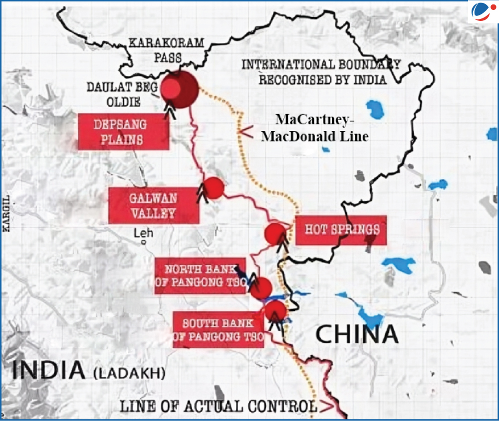
- India considers the LAC to be 3,488 km long, while China considers it to be only around 2,000 km.
- LAC is divided into three sectors
- Western Sector (Ladakh): India considers the Johnson Line (of 1865) as the border whereas China claims the McDonald Line (of 1899) as the true border.
- Middle sector (Himachal Pradesh and Uttarakhand): Largely undisputed.
- Eastern Sector (Arunachal Pradesh and Sikkim): China claims entire AP as part of the Tibetan Autonomous Region.
- The alignment of LAC is along the MacMahon Line, drawn during the 1914 Simla Convention, which China has rejected.


