
While current demand for Light Detection and Ranging (LiDAR) technology is primarily driven by autonomous vehicles, it is finding applications in a wide assortment of fields, both commercial and military.
About LiDAR
- LiDAR is a dual-use optical remote sensing technology that uses light in the form of a pulsed laser to measure distances and maps the surrounding environment.
- Types of LiDAR
- Topographic: Typically uses a near-infrared laser to map the land
- Bathymetric: Water-penetrating green light to also measure seafloor and riverbed elevations.
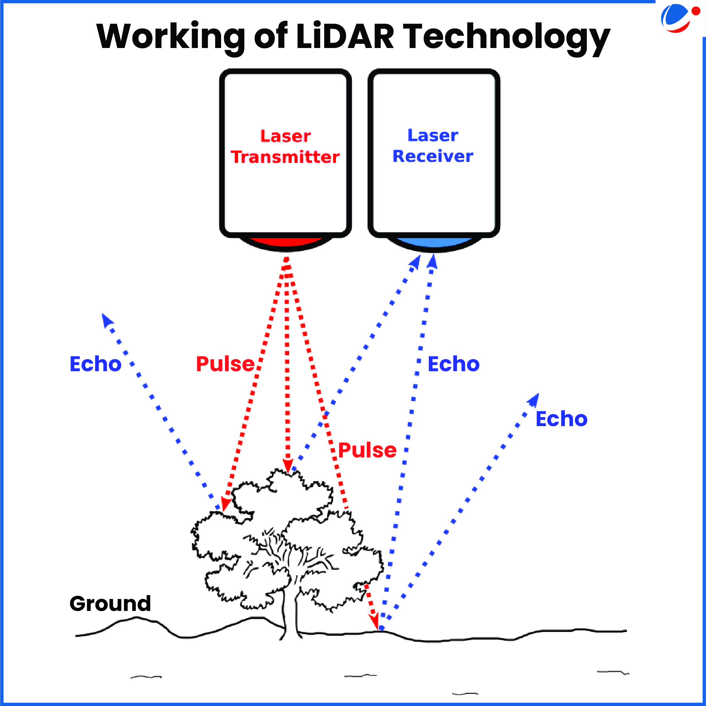
Working of LiDAR Systems
- Consist of three main components: Laser emitter, scanning mechanism, and Specialized GPS receiver.
- Works on same principles as RADAR and SONAR, i.e., emit waves of energy to detect and track objects.
- RADAR (Radio Detection and Ranging) uses microwaves; SONAR (Sonic Navigation and Ranging) uses sound waves whereas LiDAR uses light waves.
Applications of LiDAR
- Agriculture: To measure agricultural landscaping and topography, for crop biomass estimation, to detect soil properties, etc.
- Aerospace and Defense: Terrain mapping, target tracking, mine hunting and imaging through clouds Maps terrain, mission planning using sophisticated battlefield visualizations, etc.
- Automotive: Advanced driver-assistance systems (ADAS) and autonomous vehicles use 3D LiDAR map data to navigate roads.
- Others: Weather forecasting, Mapping environments in virtual reality and augmented reality applications, etc.

