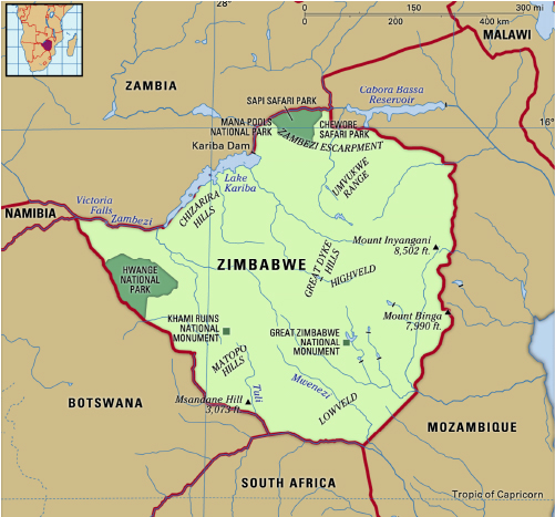
Zimbabwe (Capital: Harare)
India has extended humanitarian assistance to Zimbabwe, Malawi and Zambia to mitigate food shortages caused by severe droughts linked to the El Nino phenomenon.
Political Features

- Landlocked country in Southern Africa.
- Boundaries: South Africa (South), Botswana (west and south-west), Zambia (North), Mozambique (east and north-east).
Geographical Features
- Rivers: Zambezi (forms border between Zambia and Zimbabwe), Limpopo etc.
- Victoria Falls (one of the largest waterfalls) and Lake Kariba located on Zambezi river between Zimbabwe and Zambia.
- Veld grasslands (open woodland tropical savannah).
- Natural resources: coal, chromium ore, vanadium, lithium, tin, platinum etc.
- Highest peak: Mount Inyangani (8504 feet)


