
Why in the News?
Recently, Hilly regions of Wayanad district of Kerala experienced one of the worst landslides in recent history.
Landslide in India
- A landslide is a mass movement of material, such as rock, earth or debris, down a slope, under the influence of gravity.
- Steep slopes: Steep inclines make the mountains vulnerable to landslides from minimal water or seismic activity.
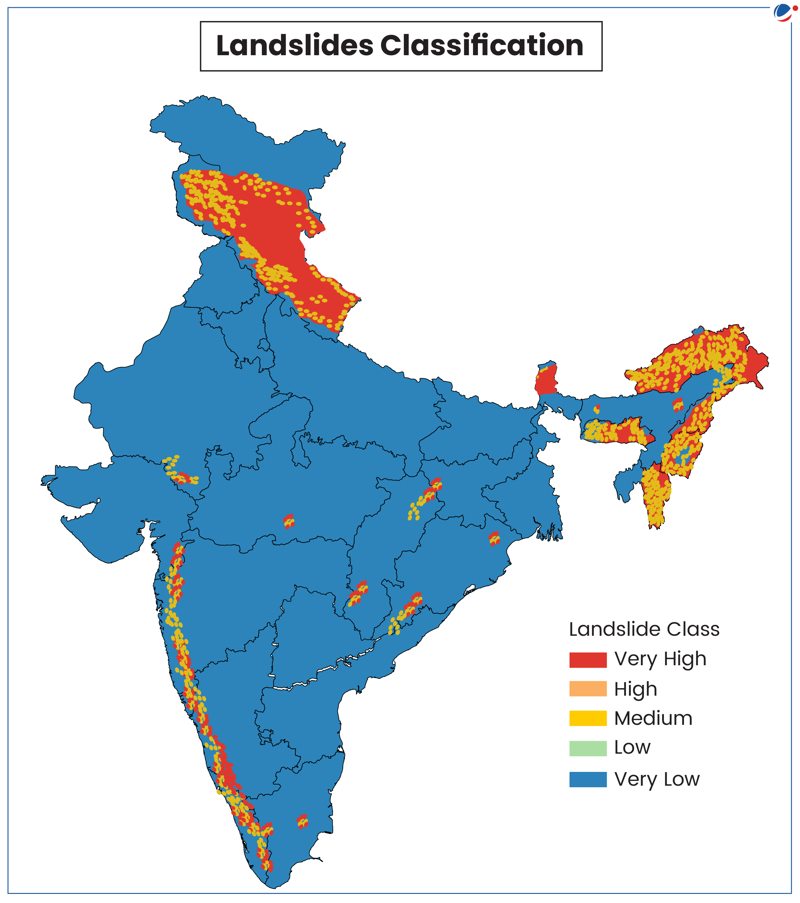
- As per India Landslide Susceptibility Map (ILSM) around 13.17% of the country is susceptible to landslides and that 4.75% is 'very highly susceptible'.
- Sikkim has 57.6% landslide-prone area, while Kerala, outside the Himalayas, has 14% of land in the 'very high susceptibility' category.
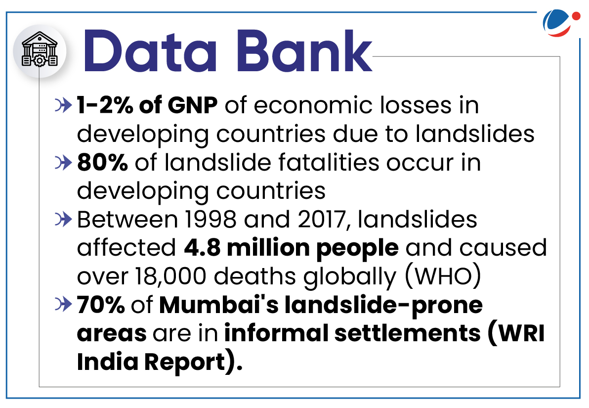
- India accounts for about 8% of global fatalities due to landslides.
Causes of landslides
Himalayan Region | Western Ghats |
|
|
Steps Taken for Mitigation of Landslides
- Early warning Forecasting: The Geological Survey of India recently established the National Landslide Forecasting Centre (NLFC) in Kolkata to enhance landslide prediction.
- Bhusanket Web Portal and Bhooskhalan Mobile App were launched to enable quick dissemination of landslide forecasts and allow stakeholders to share and update spatial and temporal information on landslide occurrences.
- National Disaster Management Authority guidelines: NDMA's Guidelines on Management of Landslides and Snow Avalanches outline the national policy for managing landslides and related activities.
- Dedicated schemes: NDMA launched the Landslide Risk Mitigation Scheme (LRMS) to financially and technically support landslide-prone states.
- National Landslide Risk Management Strategy: This strategy document addresses all the components of landslide disaster risk reduction and management, such as hazard mapping, monitoring and early warning systems, awareness programmes, capacity building and training, regulations and policies, stabilization and mitigation of landslides, etc.
- SENDAI framework: Sendai Framework for Disaster Risk Reduction 2015-2030 was the first major agreement of the post-2015 development agenda and provides Member States with concrete actions to protect development gains from the risk of disaster.
Way forward
- Accepting ESA draft notification for Western Ghats across six states: As it will become law and would impose restrictions on economic activities such as quarrying, mining, and large infrastructural development in these areas.
- Land use Zoning Regulations: Implementation of Land use Zoning Regulations based on local and site specific landslide zonation (1:10k or larger) maps be made mandatory in hills/ mountains.
- Slope modification regulations: Such as slope modification regulations of the Aizawl Municipal Corporation can be a good model for other regulatory bodies in landslide prone areas to follow
- State specific landslide mitigation strategies: Need to be formulated to address specific issues especially for each mountain state.
- Regulating Development activities: For example- Kerala should decline engineering projects in ecologically sensitive areas and establish expert committees to determine feasibility of other projects, as suggested by the Madhav Gadgil committee for Kerala.


