Hyperlocal Weather Forecasting | Current Affairs | Vision IAS
MENU
Home

Periodically curated articles and updates on national and international developments relevant for UPSC Civil Services Examination.

Quick Links

High-quality MCQs and Mains Answer Writing to sharpen skills and reinforce learning every day.

Watch explainer and thematic concept-building videos under initiatives like Deep Dive, Master Classes, etc., on important UPSC topics.

ESC

Hyperlocal Weather Forecasting

14 Nov 2024
4 min

Why in the News?

Recently, the Cos-it-FloWs, a new system that collects hyper-local data for flood forecast launched in the flood-prone Periyar and Chalakudi river basins was launched in Kerala. 

About CoS-it-FloWS 

  • CoS-it-FloWS (Community-Sourced Impact-based Flood Forecast and Early Warning System) is a project run by Equinoct, a Kochi-based community-sourced modelling solution provider. 
  • Recognized by UNICEF's Climate Tech Cohort, it uses 100 rain gauges installed across Ernakulam, Idukki, and Thrissur.
  • Data on rainfall, river, tidal and groundwater levels that are collected primarily by students, women, and youth at the household level is then analyzed and visualized through Insight Gather, a web portal to host the impact-based forecasts in the pilot basins.
  • The idea is to plug gaps in government data and to scale up the project with greater community participation by collecting hyper-local data for fighting natural disasters. 

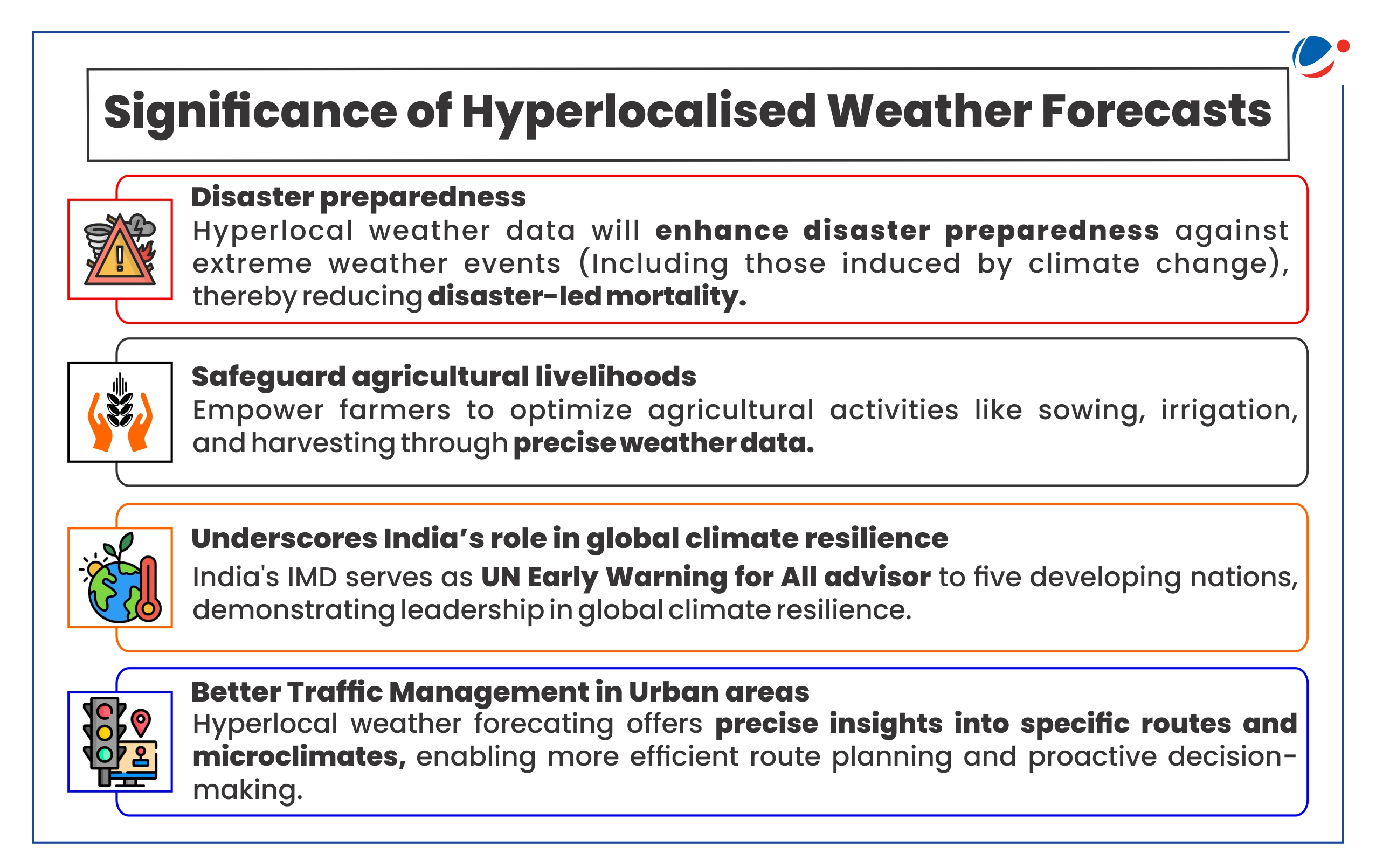
About hyperlocal weather forecasting 

  • Definition: Hyperlocal weather forecasting is a specialized form of meteorology that pinpoints weather conditions to extremely localized areas. 
  • Current forecasting level: Currently the Indian Meteorology Department (IMD) issues weather forecasting for district level. 
    • The forecast and warnings issued from National Weather Forecasting Centre (NWFC) are in the subdivisional scale for the country as a whole whereas the same from State WFC  (SWFC) are in the district scale for the state concerned. 
  • Need for Hyperlocal forecasting: In tropical countries like India, weather variability is inherently higher. Hence hyperlocalized weather forecasting is needed for better utility.
Image showing Significance of Hyperlocalised Weather Forecasts. Key significance include- •	Disaster preparedness: Hyperlocal weather data will enhance disaster preparedness against extreme weather events (Including those induced by climate change), thereby reducing disaster-led mortality. •	Safeguard agricultural livelihoods: Empower farmers to optimize agricultural activities like sowing, irrigation, and harvesting through precise weather data. •	Underscores India's role in global climate resilience: India's IMD serves as UN Early Warning for All advisor to five developing nations, demonstrating leadership in global climate resilience. •	Better Traffic Management in Urban areas: Hyperlocal weather forecasting offers precise insights into specific routes and microclimates, enabling more efficient route planning and proactive decision-making.

Key Challenges in hyperlocal weather forecasting

  • Outdated prediction models: Currently, most of the prediction software used in forecasting are based on the Global Forecasting System (GFS) and Weather Research and Forecasting (WRF) Models, both of which are not the most modern.
  • Lack of weather monitoring ground stations: Currently, IMD operates around 800 automatic weather stations (AWS), 1,500 automatic rain gauges (ARG) and 37 doppler weather radars (DWR). 
    • This is against the total requirements of more than 3,00,000 ground stations (AWS/ARG) and around 70 DWRs.
  • Underutilized data from ground stations:  Although state governments and private companies manage over 20,000 ground stations, much of this data is inaccessible to the India Meteorological Department (IMD) due to issues with data-sharing and reliability.
  • Difficulty in predicting small-scale events: Large systems like monsoons or cyclones are easier to forecast, but sudden, localized events like cloudbursts remain challenging due to their erratic and dynamic nature.
    • Increasing climate volatility leads to frequent and rapid system changes, complicating predictions even further.

Key initiatives taken to facilitate hyperlocal weather forecasting 

  • Gram Panchayat (GP)-Level Weather Forecasting: A joint program of the Ministry of Panchayati Raj Ministry, Ministry of Earth Sciences and IMD for providing hourly forecasts at GP level. 
  • Mission Mausam: It was unveiled recently to Enhance India's Weather and Climate Forecasting by 2026 by installing a wider network of radars, wind profilers, and radiometers for better observations. 
  • Weather information network and data system (WINDS): To install system of AWS and ARG across India to generate long-term, hyper-local weather data.
  • IFLOWS-Mumbai: Integrated Flood Warning System for Mumbai (IFLOWS-Mumbai) developed by Ministry of Earth Sciences in coordination with Municipal Corporation of Greater Mumbai for providing early warning for flooding specially during high rainfall events and cyclones.
  • Mumbai Flood App: It is a rainfall forecasting and flood monitoring system predicting rain hourly and daily for Mumbai. 
    • It is developed by IIT Bombay, with funding from HDFC ERGO, in collaboration with the MCGM Centre for Municipal Capacity Building and Research (MCMCR).

Conclusion

India needs a comprehensive approach to enhance hyperlocal weather forecasting. This includes upgrading to advanced models, expanding the monitoring network, fostering data-sharing, and developing robust real-time data systems. By addressing these areas, India can improve accuracy, especially for localized events, and better prepare for extreme weather.

Explore Related Content

Discover more articles, videos, and terms related to this topic

RELATED VIDEOS

3
Simplified | Education and Employment in the Climate Era

Simplified | Education and Employment in the Climate Era

YouTube HD
Forest Fires: Causes & Role of Climate Change in Increasing Incidents(Bolivian, Amazon Forest Fires)

Forest Fires: Causes & Role of Climate Change in Increasing Incidents(Bolivian, Amazon Forest Fires)

YouTube HD
Climate Change: Evolution of UNFCCC and other International Initiatives

Climate Change: Evolution of UNFCCC and other International Initiatives

YouTube HD
Title is required. Maximum 500 characters.

Search Notes

Filter Notes

Loading your notes...
Searching your notes...
Loading more notes...
You've reached the end of your notes

No notes yet

Create your first note to get started.

No notes found

Try adjusting your search criteria or clear the search.

Saving...
Saved

Please select a subject.

Referenced Articles

linked

No references added yet